
 By
Before you vote, see what your choices could mean.
We want to help you understand not just what's on the ballot, but what could happen afterward. Colorado Tradeoffs lets you test the choices, see the budget implications, and decide how you would respond.
Give it a try below. It takes less than 10 minutes.
For nearly five centuries, the world’s spatial consciousness has been anchored to a subtle, powerful distortion printed on a flat sheet of paper. In geography classrooms from London to Tokyo, and across the digital default settings of modern smartphone apps, global citizens have grown up internalizing a map where Greenland matches the immense footprint of the African continent.
It is a cartographic illusion—one that makes Greenland appear comparable in scale, even though Africa is, in reality, fourteen times larger.
Now, the international community has formally drawn a line in the sand.
Following an initiative spearheaded by Togo on behalf of the African Union, the United Nations General Assembly adopted a watershed resolution titled “Correct the map: rebalancing global cartographic representation and promoting equitable representation of the world’s regions, particularly Africa.”
The vote passed by a resounding margin of 164 in favor, delivering a direct challenge to centuries of visual bias. The measure calls upon governments, educational authorities, digital publishers, and media organizations worldwide to phase out outdated map projections that shrink the Global South while disproportionately inflating the landmasses of the Northern Hemisphere.
The Navigational Tool That Distorted History
At the heart of the UN debate is the Mercator projection, created in 1569 by Flemish cartographer Gerardus Mercator.
Mercator’s design was a brilliant triumph for 16th-century maritime navigation. By preserving true angles and straight compass lines (rhumb lines), it allowed sailors to cross vast oceans without veering off course. But wrapping a 3D sphere onto a 2D rectangle comes with an unavoidable mathematical trade-off: area distortion.
As landmasses move farther away from the Equator toward the poles, their physical size on a Mercator map swells dramatically. The result? Equatorial regions—where Africa sits squarely at the center—are visually compressed, while North America and Europe expand into vast geographical giants.
For centuries, this technical compromise went unchallenged as Mercator transitioned from mariners’ logs to elementary school walls, atlases, and eventually, the digital code of early GPS routing engines.
“Cognitive Justice”: The Argument for Equal Earth
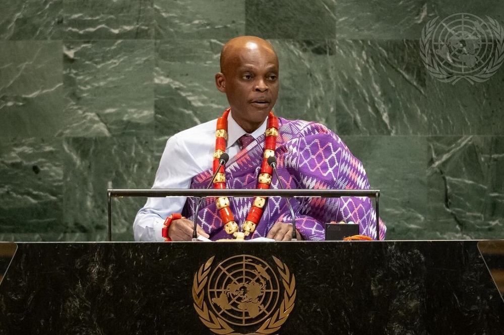
Standing before reporters at the UN headquarters, Togo’s Minister for Foreign Affairs, Robert Dussey, made it clear that the resolution was not an effort to erase scientific history, but to demand visual parity.
“A fair map does not change the geography of the world; it changes how we see the world,” Dussey stated. “This discussion is not a political discussion, but a scientific discussion.”
The resolution frames the correction as an act of “cognitive justice and memorial reparation,” pointing out that spatial perception quietly shapes geopolitical prestige, educational confidence, and economic investment.
To replace distorted projections, the UN resolution highlights alternative frameworks like the Equal Earth projection—a modern equal-area map developed in 2018 that preserves relative territorial sizes while keeping continents visually recognizable.
Geopolitical Friction on the Assembly Floor
While the vote carried an overwhelming majority, it was not without intense diplomatic friction on the UN floor.
The United States cast the lone vote against the measure, with its representative dismissing the campaign as a political distraction. American delegates argued that framing cartographic choices through the lens of ideological reparations risks undermining the core institutional work of the assembly.
Conversely, France took a dramatic, proactive stance just hours before the vote. French Foreign Minister Jean-Noël Barrot announced at Sorbonne University that Paris would formally phase out the Mercator projection in government and educational publishing, transitioning instead to equal-area representations.
Beyond Maps: Reshaping the Narrative
| Map Projection | Primary Design Purpose | Area Accuracy | Cultural & Perceptual Impact |
|---|---|---|---|
| Mercator (1569) | Maritime Navigation & Straight Compass Bearing | Highly Distorted (Exaggerates Poles) | Perpetuates symbolic minimization of equatorial regions. |
| Gall-Peters (1973) | Equal Area Representation | Accurate Area / Vertically Stretched | Early attempt to restore geographical parity; visually controversial. |
| Equal Earth (2018) | Balanced Visual Scale & Equal Area | Accurate Area | Recommended by the UN to show true continental scale. |
The UN vote marks a major victory in a broader, decadal effort by African scholars, media activists, and leaders to reclaim the narrative of the continent.
For generations, the subtle shrinking of Africa on maps reinforced a subtle visual hierarchy—a perception of a smaller, less significant landmass. By insisting that classroom walls and digital screens depict the continent at its true scale—a landmass that spans over 30 million square kilometers—the United Nations has signaled that accuracy is not merely a mathematical detail.
It is a prerequisite for respect on the world stage.